Population Agents
The Agent is the key concept in Agent Based Modelling. In the West of England model an agent is analgous to a person. Each agent has attributes such as sex, age and work status. In addition to the attributes, an agent has a plan, which is similar to an itinerary showing where the agent needs to be throughout the day for work, shopping or leisure activities.
The population file has mainly been created from census data using algorithms and probability trees to disaggregate demographic statistics. Data from the National Travel Survey (NTS) and Open Street Map (OSM) have also been used to create unique activity plans for each of the 750,000 agents.
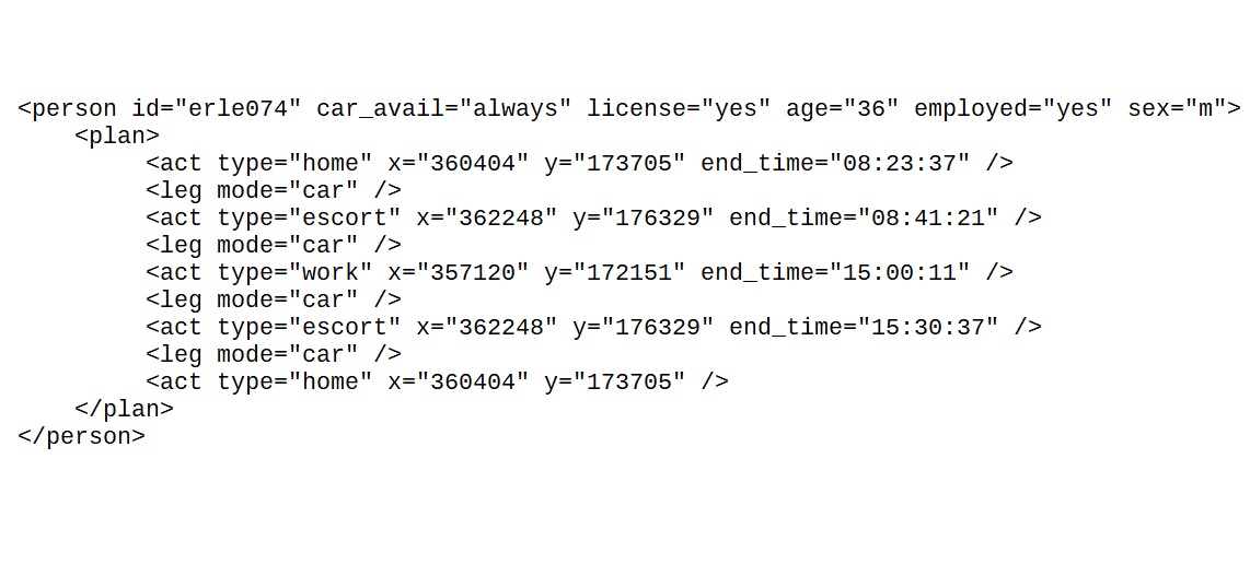
The agent plan above includes an "escort" activity to simulate a 'school run' responsibility for this agent.
Network
Alongside the population of agents, the network is the other foundational element of the MATSim model.
The network file can be split into two parts - links and nodes. Nodes are geographic points on the network. They are often located at junctions or at points where paths and roads meet each other.
Links contain attributes such as speed, capacity, length and the modes which are allowed to travel on them. Links don't contain any geographic information themselves, but each link will have a 'start node' and 'end node' attribute to define where they are located.
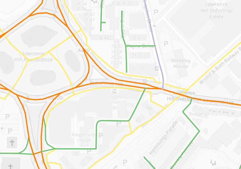
The map above illustrates how the network defines which transport modes are allowed to access different parts of the network. The yellow links on the map can only be accessed by agents using bike and walking modes.
Activity Locations
Activity locations are a key component in the creation of each agent's travel plan (or itinerary). The travel plan is a list of activity locations which they need to travel to throughout the simulated day. Usually this starts with a 'home' location, but the pattern of activity locations will be unique to each individual in the popultion file. For the West of England population 750,000 unique travel plans have been created.
This webmap shows activity locations for agents who have home locations in Yate.
Parking, Public Transport and other Model Inputs
The West of England model includes inputs for all bus services that serve stops in the region. This means that the model takes account of every individual bus service during each simulation run, and the model outputs include data on where and when each agent accesses an individual bus service. Similar inputs can be included for the rail network.
The model also includes a module for parking choice. This is an important feature because the availability of parking can suppress demand for car travel.